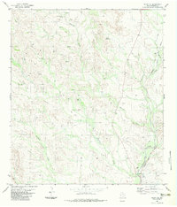
1983 Map of Plata NE
USGS Topo · Published 1983About this map
Matonoso Creek and Alamito Creek carve a complex network of drainages through the high desert of Presidio County in the early 1980s. The landscape is defined by its water sources, from Claw Hammer Spring and White Springs in the north to a Flowing Well located near the center of the quadrangle. Human presence is concentrated at remote outposts like Chaparral Ranch and Perkins Ranch, reflecting the enduring ranching economy of this West Texas region.
Find a feature on this map
17 named features on this map. Tap any name to fly to it.
Don’t see what you’re looking for? This feature index may not catch every label — zoom into the map to look around manually.
Map Details
Editions of this 1983 Plata NE Map
This is the sole edition of this map. No revisions or reprints were ever made.
Other maps of this area

1895 · Marfa
USGS Topo · 1:125,000

1895 · Alpine
USGS Topo · 1:125,000

1896 · Shafter
USGS Topo · 1:125,000

1918 · Jordan Gap
USGS Topo · 1:62,500

1930 · Jordan Gap
USGS Topo · 1:62,500

1954 · Fort Stockton
USGS Topo · 1:250,000

1958 · Fort Stockton
USGS Topo · 1:250,000

1959 · Emory Peak
USGS Topo · 1:250,000

1959 · Presidio
USGS Topo · 1:250,000

1959 · Marfa
USGS Topo · 1:250,000