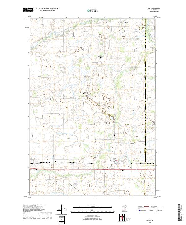
2022 Map of Plato
USGS Topo · Published 2022About this map
Agricultural patterns and an extensive system of drainage infrastructure dominate this McLeod County landscape, as evidenced by numerous channels such as County Ditch Number Thirteen and Judicial Ditch Number Eight. The settlement of Plato occupies a central position, while the eastern edge of Glencoe is visible to the west, home to the Glencoe Municipal Airport. The terrain is characterized by former water bodies like Brush Lakebed and Kennison Lakebed, which have been integrated into the surrounding farmland.
Find a feature on this map
72 named features on this map. Tap any name to fly to it.
Don’t see what you’re looking for? This feature index may not catch every label — zoom into the map to look around manually.
Map Details
Editions of this 2022 Plato Map
This is the sole edition of this map. No revisions or reprints were ever made.
Other maps of this area

1953 · Saint Paul
USGS Topo · 1:250,000

1953 · New Ulm
USGS Topo · 1:250,000

1957 · New Ulm
USGS Topo · 1:250,000

1957 · Belle Plaine
USGS Topo · 1:62,500

1957 · Waconia
USGS Topo · 1:62,500

1958 · New Ulm
USGS Topo · 1:250,000

1958 · Gaylord
USGS Topo · 1:62,500

1958 · Glencoe
USGS Topo · 1:62,500

1959 · Saint Paul
USGS Topo · 1:250,000

1967 · New Ulm
USGS Topo · 1:250,000