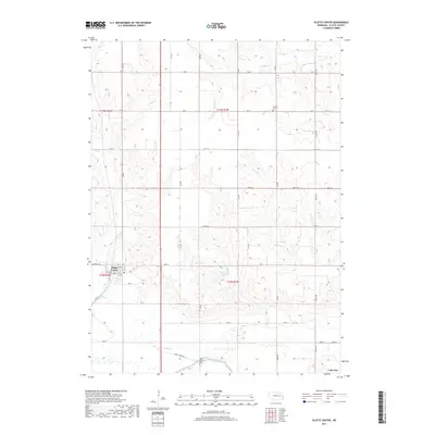
2017 Map of Platte Center
USGS Topo · Published 2017About this map
Platte Center serves as the primary hub of this eastern Nebraska agricultural landscape, where the town layout is defined by a grid of streets including Central Hwy and 1st St. The surrounding countryside in Platte County is shaped by an intricate network of waterways, most notably Shell Cr and Elm Cr, which meander through a dense section-line road system. Significant local landmarks for genealogists and historians include Saint Patricks Cem and Stretter Cem, marking early community roots. To the south, the Loup River Canal cuts across the terrain near the small settlement of Lakeview, while the Goedeken Reservoir provides a notable water management feature amidst the drainage basins of Loseke Cr and Schaad Cr.
Find a feature on this map
43 named features on this map. Tap any name to fly to it.
Don’t see what you’re looking for? This feature index may not catch every label — zoom into the map to look around manually.
Map Details
Editions of this 2017 Platte Center Map
This is the sole edition of this map. No revisions or reprints were ever made.
Other maps of this area

1896 · Stromsburg
USGS Topo · 1:125,000

1899 · David City
USGS Topo · 1:125,000

1955 · Fremont
USGS Topo · 1:250,000

1957 · Fremont
USGS Topo · 1:250,000

1958 · Fremont
USGS Topo · 1:250,000

1958 · Monroe
USGS Topo · 1:24,000

1958 · Duncan
USGS Topo · 1:24,000

1958 · Columbus
USGS Topo · 1:24,000

1966 · Tarnov
USGS Topo · 1:24,000

1966 · Platte Center
USGS Topo · 1:24,000