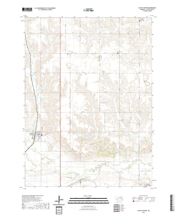
2021 Map of Platte Center
USGS Topo · Published 2021About this map
Platte Center serves as the primary hub of this eastern Nebraska landscape, where the grid of sections and avenues meets the winding course of Shell Cr. The map details the local infrastructure of the early 2020s, including a network of rural roads such as Central Hwy and S Shell Creek Rd that connect the town to outlying farms and cemeteries. This area is defined by its water management and religious heritage, as seen in the proximity of the Loup River Canal and Goedeken Reservoir to longstanding community centers like Saint Patricks and the Saint Johns Lutheran Church.
Find a feature on this map
42 named features on this map. Tap any name to fly to it.
Don’t see what you’re looking for? This feature index may not catch every label — zoom into the map to look around manually.
Map Details
Editions of this 2021 Platte Center Map
This is the sole edition of this map. No revisions or reprints were ever made.
Other maps of this area

1896 · Stromsburg
USGS Topo · 1:125,000

1899 · David City
USGS Topo · 1:125,000

1955 · Fremont
USGS Topo · 1:250,000

1957 · Fremont
USGS Topo · 1:250,000

1958 · Fremont
USGS Topo · 1:250,000

1958 · Monroe
USGS Topo · 1:24,000

1958 · Duncan
USGS Topo · 1:24,000

1958 · Columbus
USGS Topo · 1:24,000

1966 · Tarnov
USGS Topo · 1:24,000

1966 · Platte Center
USGS Topo · 1:24,000