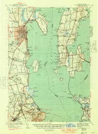
1943 Map of Plattsburg
USGS Topo · Published 1949About this map
Lake Champlain serves as the central artery for this 1930s-era survey, which captures the vital maritime and rail connections between New York and Vermont. The industrial and residential hub of Plattsburg is shown in detail, balanced by the agrarian landscape of Grand Isle. A network of ferries, including the Burlington Ferry, links the lakeshore settlements, while the Delaware and Hudson and Rutland railroads define the transportation corridors on either side of the water.
Find a feature on this map
113 named features on this map. Tap any name to fly to it.
Don’t see what you’re looking for? This feature index may not catch every label — zoom into the map to look around manually.
Map Details
Editions of this 1943 Plattsburg Map
4 editions found
Other maps of this area

1894 · Plattsburg
USGS Topo · 1:62,500

1895 · Mooers
USGS Topo · 1:62,500

1895 · Rouse Point
USGS Topo · 1:62,500

1895 · Willsboro
USGS Topo · 1:62,500

1895 · Ausable
USGS Topo · 1:62,500

1899 · Mooers
USGS Topo · 1:62,500

1903 · Ausable
USGS Topo · 1:62,500

1906 · Plattsburg
USGS Topo · 1:62,500

1906 · Burlington
USGS Topo · 1:62,500

1907 · Rouse Point
USGS Topo · 1:62,500