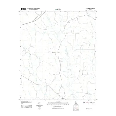
2012 Map of Plattsburg
USGS Topo · Published 2012About this map
Liberty and Plattsburg anchor this rural Mississippi landscape, where a dense network of family-named roads reveals a long history of local settlement. The area is defined by its many community burial grounds, including the Plattsburg Cem, Antioch Cem, and Thompson Cem, which serve as vital landmarks for genealogical research. The terrain is deeply carved by numerous waterways like Pinishook Cr, Alampa Cr, and Jofuska Cr, which influence the winding paths of rural routes such as Mount Calvary Church Rd and Walter Sisson Rd. In the south, the settlement of Arlington sits near the headwaters of Bear Cr, illustrating how small hamlets developed at the intersections of these creek-side road systems. This documentation captures the persistent rural character of the region, where land ownership and community identity remain tied to these named creeks and historic cemetery sites.
Find a feature on this map
73 named features on this map. Tap any name to fly to it.
Don’t see what you’re looking for? This feature index may not catch every label — zoom into the map to look around manually.
Map Details
Editions of this 2012 Plattsburg Map
This is the sole edition of this map. No revisions or reprints were ever made.
Other maps of this area

1953 · Meridian
USGS Topo · 1:250,000

1953 · West Point
USGS Topo · 1:250,000

1957 · Meridian
USGS Topo · 1:250,000

1958 · West Point
USGS Topo · 1:250,000

1962 · Edinburg
USGS Topo · 1:62,500

1963 · West Point
USGS Topo · 1:250,000

1965 · Meridian
USGS Topo · 1:250,000

1972 · Pearl River
USGS Topo · 1:24,000

1972 · Plattsburg
USGS Topo · 1:24,000
1972 · Ethel SE
USGS Topo · 1:24,000