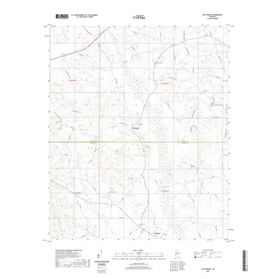
2020 Map of Plattsburg
USGS Topo · Published 2020About this map
The boundary between Winston Co and Neshoba Co bisects this landscape of winding creeks and rural settlements. Plattsburg serves as a central hub, surrounded by a high density of small family and community burial grounds including Plattsburg Cem, Antioch Cem, and Liberty Cem. The local road network, featuring names like Yarbrough Carter Rd and Roosevelt Young Rd, reflects a pattern of family-held lands and long-standing local heritage. Watercourses such as Finishook Cr and Mimes Br drain the territory, while the southern settlement of Arlington anchors the lower portion of the map. This area is characterized by a high number of genealogical markers, with scattered sites like Lee Cem and Mount Talley Cem providing specific points of interest for family historians tracing roots in central Mississippi.
Find a feature on this map
74 named features on this map. Tap any name to fly to it.
Don’t see what you’re looking for? This feature index may not catch every label — zoom into the map to look around manually.
Map Details
Editions of this 2020 Plattsburg Map
This is the sole edition of this map. No revisions or reprints were ever made.
Other maps of this area

1953 · Meridian
USGS Topo · 1:250,000

1953 · West Point
USGS Topo · 1:250,000

1957 · Meridian
USGS Topo · 1:250,000

1958 · West Point
USGS Topo · 1:250,000

1962 · Edinburg
USGS Topo · 1:62,500

1963 · West Point
USGS Topo · 1:250,000

1965 · Meridian
USGS Topo · 1:250,000

1972 · Pearl River
USGS Topo · 1:24,000

1972 · Plattsburg
USGS Topo · 1:24,000
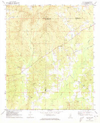
1972 · Ethel SE
USGS Topo · 1:24,000