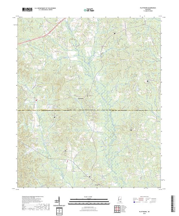
2024 Map of Plattsburg
USGS Topo · Published 2024About this map
Plattsburg and Arlington anchor this rural landscape along the boundary of Winston and Neshoba counties. The area is defined by a dense network of country roads named for local families, including Yarbrough Carter Rd, Fred Holdiness Rd, and Roosevelt Young Rd, suggesting a deeply rooted community structure. This intricate geography is further punctuated by numerous burial grounds such as Liberty Cem, Antioch Cem, and Sand Hill Cem, which serve as vital landmarks for genealogical research.
Find a feature on this map
70 named features on this map. Tap any name to fly to it.
Don’t see what you’re looking for? This feature index may not catch every label — zoom into the map to look around manually.
Map Details
Editions of this 2024 Plattsburg Map
This is the sole edition of this map. No revisions or reprints were ever made.
Other maps of this area

1953 · Meridian
USGS Topo · 1:250,000

1953 · West Point
USGS Topo · 1:250,000

1957 · Meridian
USGS Topo · 1:250,000

1958 · West Point
USGS Topo · 1:250,000

1962 · Edinburg
USGS Topo · 1:62,500

1963 · West Point
USGS Topo · 1:250,000

1965 · Meridian
USGS Topo · 1:250,000

1972 · Pearl River
USGS Topo · 1:24,000

1972 · Plattsburg
USGS Topo · 1:24,000
1972 · Ethel SE
USGS Topo · 1:24,000