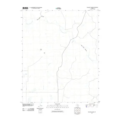
2010 Map of Pleasant Creek
USGS Topo · Published 2010About this map
Palo Duro Canyon dominates this landscape, its deep incisions carved into the Texas Panhandle by the Prairie Dog Town Fork Red River. This 2010 survey illustrates the complex drainage system of the High Plains, where tributaries like Happy Canyon and Pleasant Creek feed into the primary river channel. The map details a transition from the level plateau surface, marked by landmarks such as Road Point, to the steep, erosional topography of the canyon floor. Transportation in this rural Armstrong County area is defined by the grid-like path of Wayside Rd and local county roads that navigate the dramatic changes in elevation. The survey also captures numerous ephemeral watercourses, including Coyote Creek and Dyer Creek, which characterize the semi-arid hydrology of the region.
Find a feature on this map
12 named features on this map. Tap any name to fly to it.
Don’t see what you’re looking for? This feature index may not catch every label — zoom into the map to look around manually.
Map Details
Editions of this 2010 Pleasant Creek Map
This is the sole edition of this map. No revisions or reprints were ever made.
Other maps of this area

1954 · Plainview
USGS Topo · 1:250,000

1958 · Plainview
USGS Topo · 1:250,000

1960 · Wayside
USGS Topo · 1:62,500

1963 · Luttrell Springs
USGS Topo · 1:24,000

1963 · Luttrell Springs NE
USGS Topo · 1:24,000

1963 · Pleasant Creek
USGS Topo · 1:24,000
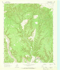
1963 · Gip Creek
USGS Topo · 1:24,000

1965 · Big Betty Reservoir
USGS Topo · 1:24,000

1965 · Vigo Park
USGS Topo · 1:24,000

1969 · Jackson Hill
USGS Topo · 1:24,000