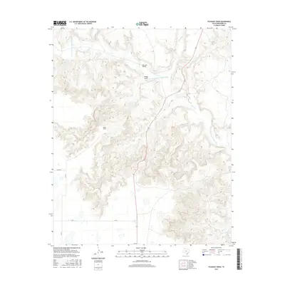
2016 Map of Pleasant Creek
USGS Topo · Published 2016About this map
Palo Duro Canyon dominates this section of Armstrong County, showcasing a landscape defined by dramatic elevation changes and the erosive power of the Prairie Dog Town Fork Red River. The drainage network is complex, with Salt Fork, Coyote Cr, and Deer Cr carving through the high plains. Smaller landforms such as Happy Canyon and the prominent Road Point provide specific geographic markers within the larger canyon system. Human activity is represented by a sparse network of county roads and state routes, including Wayside Rd and Highway 207, which navigate the plateaus above the breaks. The presence of Pleasant Creek and various farm-to-market roads like FM 285 indicate the rural agricultural character of the region on the canyon's edge.
Find a feature on this map
13 named features on this map. Tap any name to fly to it.
Don’t see what you’re looking for? This feature index may not catch every label — zoom into the map to look around manually.
Map Details
Editions of this 2016 Pleasant Creek Map
This is the sole edition of this map. No revisions or reprints were ever made.
Other maps of this area

1954 · Plainview
USGS Topo · 1:250,000

1958 · Plainview
USGS Topo · 1:250,000

1960 · Wayside
USGS Topo · 1:62,500

1963 · Luttrell Springs
USGS Topo · 1:24,000

1963 · Luttrell Springs NE
USGS Topo · 1:24,000

1963 · Pleasant Creek
USGS Topo · 1:24,000
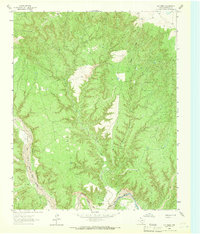
1963 · Gip Creek
USGS Topo · 1:24,000

1965 · Big Betty Reservoir
USGS Topo · 1:24,000

1965 · Vigo Park
USGS Topo · 1:24,000

1969 · Jackson Hill
USGS Topo · 1:24,000