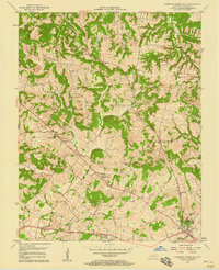
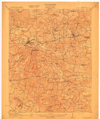
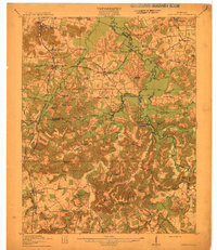
1957 Map of Pleasant Green Hill
USGS Topo · Published 1958About this map
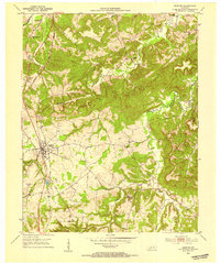
Sinking Fork and the Muddy Fork create a complex drainage pattern across this 1950s Kentucky landscape, where small agricultural communities are centered around rural congregations and burial grounds. The map reveals a dense network of local institutions, from the West Mt Zoar Ch in the northeast to the Harmony Grove Cem & Ch and Palestine Ch. Transportation in this era is defined by the Jeff Davis Highway cutting through the southern portion of the quadrangle near the settlement of Gordons. Significant local landmarks provide insight into mid-century community life, including the County Hospital, a Radio Tower (WHOP), and a Drive-in Theater. The presence of numerous family and church-affiliated cemeteries, such as the Fuller Cem and Boyd Cem, makes this an essential document for tracing the genealogy of Christian County families.
Find a feature on this map
34 named features on this map. Tap any name to fly to it.
Don’t see what you’re looking for? This feature index may not catch every label — zoom into the map to look around manually.
Map Details
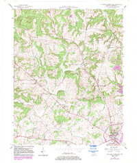
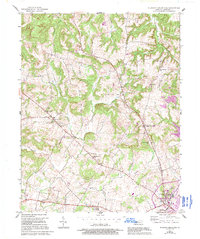
Editions of this 1957 Pleasant Green Hill Map
3 editions found
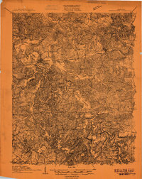
Other maps of this area
1909 · Dawson Springs
USGS Topo · 1:48,000
1911 · Dawson Springs
USGS Topo · 1:62,500
1912 · Nortonville
USGS Topo · 1:62,500

1950 · Caledonia
USGS Topo · 1:24,000

1951 · Church Hill
USGS Topo · 1:24,000

1951 · Caledonia
USGS Topo · 1:24,000
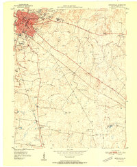
1951 · Hopkinsville
USGS Topo · 1:24,000
1952 · Pleasant Green Hill
USGS Topo · 1:24,000

1952 · Kelly
USGS Topo · 1:24,000
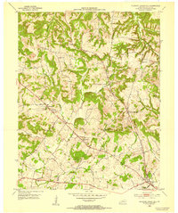
1952 · Crofton
USGS Topo · 1:24,000