
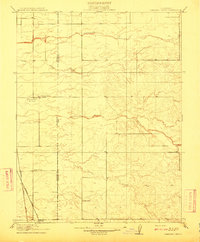
1910 Map of Pleasant Grove
USGS Topo · Published 1910About this map
Pleasant Grove and the surrounding agricultural lands of the Sacramento Valley are captured here just before the era of widespread highway development. The landscape is defined by its natural drainage systems, such as Auburn Ravine and Pleasant Grove Creek, which meander through the central and northern sections of the sheet. At the southern edge, the small settlement of Riego sits along the route of the Northern Electric RR, reflecting the importance of interurban electric rail in early twentieth-century California transport.
Find a feature on this map
11 named features on this map. Tap any name to fly to it.
Don’t see what you’re looking for? This feature index may not catch every label — zoom into the map to look around manually.
Map Details
Editions of this 1910 Pleasant Grove Map
2 editions found
Other maps of this area

1891 · Sacramento
USGS Topo · 1:125,000

1892 · Sacramento
USGS Topo · 1:125,000

1893 · Sacramento
USGS Topo · 1:125,000

1902 · Fairoaks
USGS Topo · 1:62,500

1907 · Davisville
USGS Topo · 1:62,500

1910 · Sheridan
USGS Topo · 1:31,680

1910 · Lincoln
USGS Topo · 1:31,680

1910 · Roseville
USGS Topo · 1:31,680

1910 · Vernon
USGS Topo · 1:31,680

1910 · Nicolaus
USGS Topo · 1:31,680