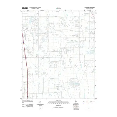
2010 Map of Pleasant Hill
USGS Topo · Published 2010About this map
Mount Olive Cemetery and Shiloh Cemetery anchor this landscape along the Tennessee and Mississippi border during the transition to modern suburban development. The map reveals an intricate network of residential streets such as Dickens Place Dr and Neelwood Dr carved into a terrain defined by numerous waterways. Small burial grounds like Jeremiah Cemetery and Phoenix Cemetery are preserved amidst this growth, offering valuable touchstones for genealogists tracing family names from the region's agricultural past. The drainage of the land is visible through the winding paths of Horn Lake Creek and Bean Patch Creek, which feed into local catchments like Sunrise Lake. Longstanding transit corridors like Swinnea Rd and Tchulahoma Rd provide the framework for the area's ongoing expansion.
Find a feature on this map
59 named features on this map. Tap any name to fly to it.
Don’t see what you’re looking for? This feature index may not catch every label — zoom into the map to look around manually.
Map Details
Editions of this 2010 Pleasant Hill Map
This is the sole edition of this map. No revisions or reprints were ever made.
Other maps of this area

1916 · Memphis
USGS Topo · 1:62,500

1925 · Memphis
USGS Topo · 1:48,000

1927 · Memphis
USGS Topo · 1:62,500

1932 · Horn Lake
USGS Topo · 1:48,000

1935 · Horn Lake
USGS Topo · 1:62,500

1939 · Memphis
USGS Topo · 1:62,500

1944 · Hernando
USGS Topo · 1:62,500

1948 · Helena
USGS Topo · 1:250,000

1950 · Helena
USGS Topo · 1:250,000

1953 · Memphis
USGS Topo · 1:250,000