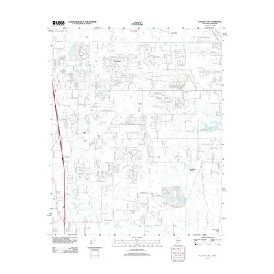
2012 Map of Pleasant Hill
USGS Topo · Published 2012About this map
Pleasant Hill and the surrounding suburbs south of Memphis are documented here during a period of significant residential expansion. The landscape is a mix of established rural settlements and newer subdivisions, characterized by a dense network of local roads such as Pigeon Roost Rd and Airport Industrial Dr. This 2012 survey provides valuable data for genealogists, as it identifies numerous family and community burial grounds, including Saint Thomas Cem, Jeremiah Cem, and Nesbit Cem. The drainage patterns of the region are defined by several watercourses, most notably Horn Lake Cr and Hurricane Cr, which flow through the developing residential blocks. Small bodies of water like Sunrise Lake and Sunset Lake appear as central features within local neighborhoods, reflecting the changing land use from agricultural fields to planned communities.
Find a feature on this map
279 named features on this map. Tap any name to fly to it.
Don’t see what you’re looking for? This feature index may not catch every label — zoom into the map to look around manually.
Map Details
Editions of this 2012 Pleasant Hill Map
This is the sole edition of this map. No revisions or reprints were ever made.
Other maps of this area

1916 · Memphis
USGS Topo · 1:62,500

1925 · Memphis
USGS Topo · 1:48,000

1927 · Memphis
USGS Topo · 1:62,500

1932 · Horn Lake
USGS Topo · 1:48,000

1935 · Horn Lake
USGS Topo · 1:62,500

1939 · Memphis
USGS Topo · 1:62,500

1944 · Hernando
USGS Topo · 1:62,500

1948 · Helena
USGS Topo · 1:250,000

1950 · Helena
USGS Topo · 1:250,000

1953 · Memphis
USGS Topo · 1:250,000