2024 Map of Pleasant Hill
USGS Topo · Published 2024About this map
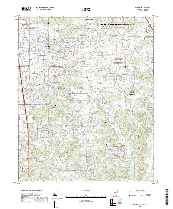
Southaven and Olive Branch serve as the primary hubs of this northern DeSoto County landscape, where the southern outskirts of Memphis meet the developing suburbs of Mississippi. The map reveals a dense network of residential subdivisions and local roads like Goodman Rd and College Rd, interspersed with numerous small, historic burial grounds. For those tracing local families, cemeteries such as Jeremiah Cem, Shiloh Cem, and Nesbit Cem provide vital links to the area's older rural communities. The natural drainage of the region is defined by winding waterways, including Hurricane Creek, Horn Lake Creek, and Rocky Creek, which flow through the undulating terrain. To the south, Sunrise Lake and Sunset Lake sit near the growing community of Bridgetown, illustrating the continued transition of former farmlands into planned residential lakeside developments along the state line.
Find a feature on this map
126 named features on this map. Tap any name to fly to it.
Don’t see what you’re looking for? This feature index may not catch every label — zoom into the map to look around manually.
Map Details
Editions of this 2024 Pleasant Hill Map
This is the sole edition of this map. No revisions or reprints were ever made.
Historical Maps of Jago Through Time
3 maps found