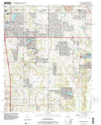
1996 Map of Pleasant Hill
USGS Topo · Published 2001About this map
Southaven and Hernando anchor this survey of the northern Mississippi borderlands, just south of the Tennessee Mississippi state line. The landscape is defined by the headwaters and drainage basins of several prominent local waterways, including Horn Creek, Nolehoe Creek, and Hurricane Creek. These natural features are interspersed with small unincorporated settlements like Plum Point and Nesbitt, reflecting the rural-to-suburban transition of De Soto Co during the late twentieth century.
Find a feature on this map
26 named features on this map. Tap any name to fly to it.
Don’t see what you’re looking for? This feature index may not catch every label — zoom into the map to look around manually.
Map Details
Editions of this 1996 Pleasant Hill Map
This is the sole edition of this map. No revisions or reprints were ever made.
Other maps of this area

1916 · Memphis
USGS Topo · 1:62,500

1925 · Memphis
USGS Topo · 1:48,000

1927 · Memphis
USGS Topo · 1:62,500

1932 · Horn Lake
USGS Topo · 1:48,000

1935 · Horn Lake
USGS Topo · 1:62,500

1939 · Memphis
USGS Topo · 1:62,500

1944 · Hernando
USGS Topo · 1:62,500

1948 · Helena
USGS Topo · 1:250,000

1950 · Helena
USGS Topo · 1:250,000

1953 · Memphis
USGS Topo · 1:250,000