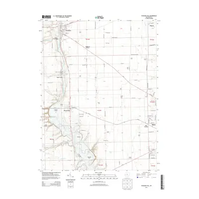
2013 Map of Pleasant Hill
USGS Topo · Published 2013About this map
The Stillwater River carves a winding path through this portion of Miami County, creating distinctive geographic features such as the Big Bend and Horseshoe Bend. The landscape is a well-established patchwork of agricultural holdings and small settlements, including the village of Pleasant Hill and the southern edge of Covington. This modern survey documents a rural economy still deeply rooted in family-named land tracts, where long-standing properties like the Lavy Dairy Farm, Fisher Farms, and Wolfe Farms sit alongside smaller airstrips like the Leavelle Airstrip. Historical continuity is evident in the preservation of local burial grounds, including Old Union Cem and Sugar Grove Cem, which serve as primary touchstones for genealogical research in Newton and Covington Townships. The intersection of natural watercourses like Canyon Run and Opossum Run with local thoroughfares like Oh-41 illustrates the enduring layout of this Western Ohio farming community.
Find a feature on this map
150 named features on this map. Tap any name to fly to it.
Don’t see what you’re looking for? This feature index may not catch every label — zoom into the map to look around manually.
Map Details
Editions of this 2013 Pleasant Hill Map
This is the sole edition of this map. No revisions or reprints were ever made.
Other maps of this area

1904 · Dayton
USGS Topo · 1:62,500

1905 · Brookville
USGS Topo · 1:62,500

1906 · Dayton
USGS Topo · 1:62,500

1911 · Covington
USGS Topo · 1:62,500

1914 · Troy
USGS Topo · 1:62,500

1944 · Covington
USGS Topo · 1:62,500

1944 · Troy
USGS Topo · 1:62,500

1953 · Cincinnati
USGS Topo · 1:250,000

1953 · Muncie
USGS Topo · 1:250,000

1955 · West Milton
USGS Topo · 1:24,000