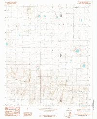
1985 Map of Pleasant Hill NE
USGS Topo · Published 1985About this map
The High Plains landscape along the New Mexico-Texas state line is defined by the ephemeral winding path of Frio Draw. In the mid-1980s, this border region between Curry County and Parmer County was characterized by a high density of agricultural wells and scattered windbreaks. The topography is relatively flat, typical of the Llano Estacado, though the terrain descends toward the drainage basin of the draw. A lone Radio Tower stands as a prominent man-made landmark in this sparse ranching and farming territory. This survey captures the rural infrastructure of the region before modern expansion, showcasing a grid of section lines and water management points that sustained the local economy during this era.
Find a feature on this map
5 named features on this map. Tap any name to fly to it.
Don’t see what you’re looking for? This feature index may not catch every label — zoom into the map to look around manually.
Map Details
Editions of this 1985 Pleasant Hill NE Map
This is the sole edition of this map. No revisions or reprints were ever made.
Other maps of this area

1954 · Clovis
USGS Topo · 1:250,000

1957 · Pleasant Hill
USGS Topo · 1:62,500

1958 · Clovis
USGS Topo · 1:250,000

1965 · Bovina
USGS Topo · 1:24,000

1965 · Rhea
USGS Topo · 1:24,000

1971 · Garcia Lake
USGS Topo · 1:24,000

1971 · Broadview
USGS Topo · 1:24,000

1971 · Bellview
USGS Topo · 1:24,000

1985 · Pleasant Hill NW
USGS Topo · 1:24,000

1985 · Pleasant Hill
USGS Topo · 1:24,000