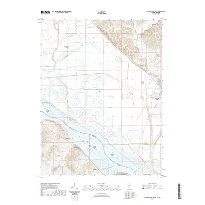
2021 Map of Pleasant Hill West
USGS Topo · Published 2021About this map
Mississippi River bottomlands dominate this 2021 landscape, where the border between Illinois and Missouri is defined by the shifting course of the great river and its complex system of sloughs and ditches. The village of Pleasant Hill sits on the eastern edge of the flood plain, just below the bluffs where several family burial grounds, including Sapp Cem and Wells Cem, are located. The extensive drainage network is anchored by The Sny and the Sixmile Creek Diversion Ditch, which channel water through the fertile lowlands. Across the water in Missouri, the terrain rises sharply at Jaeger Knob near the small settlement of McIntosh. This modern survey details the intricate relationship between the river's numerous islands, such as Middleton Island and Cash Island, and the agricultural infrastructure of Pike and Calhoun counties.
Find a feature on this map
68 named features on this map. Tap any name to fly to it.
Don’t see what you’re looking for? This feature index may not catch every label — zoom into the map to look around manually.
Map Details
Editions of this 2021 Pleasant Hill West Map
This is the sole edition of this map. No revisions or reprints were ever made.
Other maps of this area

1890 · Louisiana
USGS Topo · 1:125,000

1926 · Pittsfield
USGS Topo · 1:62,500

1930 · Nebo
USGS Topo · 1:62,500

1931 · Barry
USGS Topo · 1:62,500

1934 · Nebo
USGS Topo · 1:48,000

1936 · Barry
USGS Topo · 1:48,000

1937 · Bowling Green
USGS Topo · 1:62,500

1940 · Bowling Green
USGS Topo · 1:62,500

1942 · Nebo
USGS Topo · 1:62,500

1944 · Barry
USGS Topo · 1:62,500