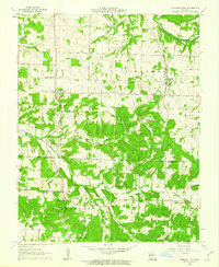
1961 Map of Pleasant Hope
USGS Topo · Published 1962About this map
Pleasant Hope and Brighton anchor this early 1960s landscape, positioned along the border between Polk and Greene Counties. The terrain is defined by a dense network of country roads connecting numerous rural congregations, including Highway Assembly Ch, Pender Chapel, and Lone Star Ch. The area shows a well-established community infrastructure with local gathering points like the New Hope Sch and Good Samaritan Ranch.
Find a feature on this map
30 named features on this map. Tap any name to fly to it.
Don’t see what you’re looking for? This feature index may not catch every label — zoom into the map to look around manually.
Map Details
Editions of this 1961 Pleasant Hope Map
2 editions found
Other maps of this area

1884 · Springfield
USGS Topo · 1:125,000

1884 · Bolivar
USGS Topo · 1:125,000

1886 · Springfield
USGS Topo · 1:125,000

1892 · Bolivar
USGS Topo · 1:125,000

1946 · Bassville
USGS Topo · 1:24,000

1947 · Strafford
USGS Topo · 1:62,500

1948 · Bassville
USGS Topo · 1:24,000

1948 · Willard
USGS Topo · 1:24,000

1948 · Ebenezer
USGS Topo · 1:24,000

1948 · Strafford
USGS Topo · 1:62,500