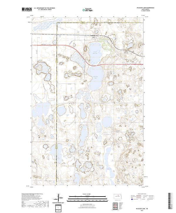
2024 Map of Pleasant Lake
USGS Topo · Published 2024About this map
The glacial prairie landscape of the Pierce Co Benson Co border is defined by an extensive network of wetlands and conservation lands. The Benson County Waterfowl Production Area and Pierce County Waterfowl Production Area dominate the geography, preserving the critical pothole lakes that characterize this region. Large water bodies such as Pleasant Lake, Broken Bone Lake, and Horseshoe Lake are central features, surrounded by a grid of rural routes including Oak Lane Rd and Co Rd 0305. The terrain is generally level, punctuated by subtle elevations like Broken Bone Hill near Mud Lake. This modern survey illustrates the contemporary balance between agricultural land divisions and large-scale federal and county conservation efforts focused on protecting North Dakota's migratory bird habitats.
Find a feature on this map
25 named features on this map. Tap any name to fly to it.
Don’t see what you’re looking for? This feature index may not catch every label — zoom into the map to look around manually.
Map Details
Editions of this 2024 Pleasant Lake Map
This is the sole edition of this map. No revisions or reprints were ever made.
Other maps of this area

1953 · Devils Lake
USGS Topo · 1:250,000

1954 · Rugby NW
USGS Topo · 1:24,000

1955 · Rugby
USGS Topo · 1:24,000

1956 · Devils Lake
USGS Topo · 1:250,000

1958 · Fillmore
USGS Topo · 1:24,000
1958 · Silva
USGS Topo · 1:24,000

1958 · Baker
USGS Topo · 1:24,000

1971 · Wolford
USGS Topo · 1:24,000

1971 · Knox
USGS Topo · 1:24,000

1971 · Rugby NE
USGS Topo · 1:24,000