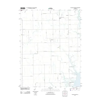
2012 Map of Pleasant Mound
USGS Topo · Published 2012About this map
Pleasant Mound and the surrounding Bond County countryside appear in this detailed survey, characterized by a grid of rural roads and scattered small communities. The map captures the agricultural and residential layout of Hookdale and Tamalco, while the southern edge of the quadrangle touches the northern reaches of Carlyle Lake. Significant for local family historians, the sheet identifies numerous burial grounds including Saint Peters Cem, Noffsinger Cem, Payne Cem, and Duncan Cem, which are often the primary records for nineteenth and twentieth-century rural residents.
Find a feature on this map
64 named features on this map. Tap any name to fly to it.
Don’t see what you’re looking for? This feature index may not catch every label — zoom into the map to look around manually.
Map Details
Editions of this 2012 Pleasant Mound Map
This is the sole edition of this map. No revisions or reprints were ever made.
Other maps of this area

1910 · Carlyle
USGS Topo · 1:62,500

1914 · Centralia
USGS Topo · 1:62,500

1932 · Greenville
USGS Topo · 1:62,500

1935 · Centralia
USGS Topo · 1:62,500

1939 · Greenville
USGS Topo · 1:62,500

1943 · Greenville
USGS Topo · 1:62,500

1945 · Vandalia
USGS Topo · 1:62,500

1947 · Vandalia
USGS Topo · 1:62,500

1948 · Carlyle
USGS Topo · 1:62,500

1958 · Belleville
USGS Topo · 1:250,000