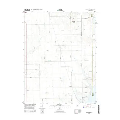
2015 Map of Pleasant Mound
USGS Topo · Published 2015About this map
The boundary between Bond and Fayette counties defines the eastern edge of this rural Illinois landscape, where small agricultural settlements have persisted for generations. Hookdale and Tamalco sit along a network of section-line roads, such as Tamalco Ave and Hookdale Ave, which connect these hamlets to the surrounding farmsteads. To the south, the terrain descends toward the water at Keyesport Landing, reflecting the area's relationship with the local drainage systems of Keysport Br and Hurricane Creek. Local family history is preserved in several small burial grounds scattered across the township, including Noffsinger Cem and Saint Peters Cem. Further north, the namesake community of Pleasant Mound and the cluster at Hamburg mark the higher ground above the well-defined valley of Willow Br.
Find a feature on this map
44 named features on this map. Tap any name to fly to it.
Don’t see what you’re looking for? This feature index may not catch every label — zoom into the map to look around manually.
Map Details
Editions of this 2015 Pleasant Mound Map
This is the sole edition of this map. No revisions or reprints were ever made.
Other maps of this area

1910 · Carlyle
USGS Topo · 1:62,500

1914 · Centralia
USGS Topo · 1:62,500

1932 · Greenville
USGS Topo · 1:62,500

1935 · Centralia
USGS Topo · 1:62,500

1939 · Greenville
USGS Topo · 1:62,500

1943 · Greenville
USGS Topo · 1:62,500

1945 · Vandalia
USGS Topo · 1:62,500

1947 · Vandalia
USGS Topo · 1:62,500

1948 · Carlyle
USGS Topo · 1:62,500

1958 · Belleville
USGS Topo · 1:250,000