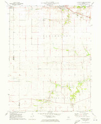
1971 Map of Pleasant Plains
USGS Topo · Published 1973About this map
Agricultural lands of Sangamon and Morgan counties define this early 1970s landscape, where the Baltimore and Ohio railroad cuts a diagonal path through the northern plains. The settlement of Pleasant Plains serves as a primary hub along the railway and Route 125, while the smaller community of Berlin anchors the southern portion of the map in Island Grove township.
Find a feature on this map
18 named features on this map. Tap any name to fly to it.
Don’t see what you’re looking for? This feature index may not catch every label — zoom into the map to look around manually.
Map Details
Editions of this 1971 Pleasant Plains Map
This is the sole edition of this map. No revisions or reprints were ever made.
Other maps of this area

1909 · Tallula
USGS Topo · 1:62,500

1924 · Waverly
USGS Topo · 1:62,500

1926 · Waverly
USGS Topo · 1:62,500

1932 · Jacksonville
USGS Topo · 1:62,500

1932 · Virginia
USGS Topo · 1:62,500

1936 · Virginia
USGS Topo · 1:62,500

1937 · Jacksonville
USGS Topo · 1:62,500

1940 · Tallula
USGS Topo · 1:62,500

1948 · Quincy
USGS Topo · 1:250,000

1956 · Quincy
USGS Topo · 1:250,000