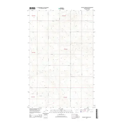
2014 Map of Pleasant Prairie NW
USGS Topo · Published 2014About this map
Orville Cem stands as a quiet focal point in this portion of the northern plains, reflecting the rural legacy of Roosevelt County and Daniels County. The landscape is defined by the subtle drainage patterns of Smoke Cr and Eagle Cr, which weave through a grid of section lines and secondary roads. This network, including Mail Route Rd and Hammar Rd, indicates a long-standing system of land division and local connectivity in a region primarily dedicated to agricultural use. While the topography is largely characterized by low-relief drainage basins, the presence of specific family or locally named roads like Vaubel Rd, Linder Rd, and Mohn Rd provides valuable clues for genealogists and local historians tracing land ownership and settlement patterns in the Pleasant Prairie area during the early 21st century.
Find a feature on this map
26 named features on this map. Tap any name to fly to it.
Don’t see what you’re looking for? This feature index may not catch every label — zoom into the map to look around manually.
Map Details
Editions of this 2014 Pleasant Prairie NW Map
This is the sole edition of this map. No revisions or reprints were ever made.
Other maps of this area

1954 · Wolf Point
USGS Topo · 1:250,000

1958 · Wolf Point
USGS Topo · 1:250,000

1973 · Madoc
USGS Topo · 1:24,000

1973 · Flaxville
USGS Topo · 1:24,000

1973 · Bredette
USGS Topo · 1:24,000

1973 · Navajo
USGS Topo · 1:24,000

1973 · Line Coulee
USGS Topo · 1:24,000

1973 · Pleasant Prairie
USGS Topo · 1:24,000

1973 · Pleasant Prairie NW
USGS Topo · 1:24,000

1973 · Pleasant Prairie SW
USGS Topo · 1:24,000