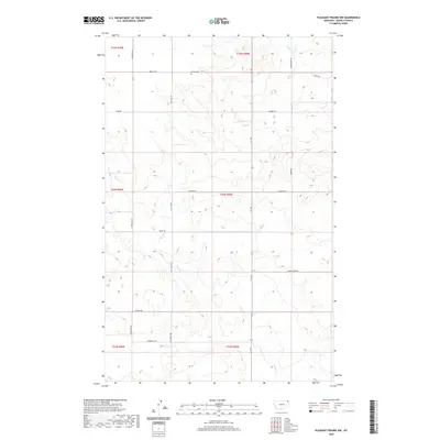
2020 Map of Pleasant Prairie NW
USGS Topo · Published 2020About this map
Orville Cem sits on a high point north of Orville Rd, overlooking a landscape defined by the drainage patterns of Smoke Cr and Eagle Cr in northeastern Montana. This 2020 survey of the Poplar District reflects a remote agricultural and ranching environment where the grid of the Public Land Survey System heavily dictates the modern road network. These straight-line passages, including Rangeline Rd and Mail Rte Rd, cut across the undulating terrain, while historical travel ways like the R-Y Trl and Smoke Creek Rd follow the more natural contours of the coulees. The map serves as a precise record of late-modern rural land management, highlighting named family and local routes such as Vaubel Rd, W Bjerke Rd, and Kurtz Rd that connect isolated farmsteads across Roosevelt and Daniels counties.
Find a feature on this map
22 named features on this map. Tap any name to fly to it.
Don’t see what you’re looking for? This feature index may not catch every label — zoom into the map to look around manually.
Map Details
Editions of this 2020 Pleasant Prairie NW Map
This is the sole edition of this map. No revisions or reprints were ever made.
Other maps of this area

1954 · Wolf Point
USGS Topo · 1:250,000

1958 · Wolf Point
USGS Topo · 1:250,000

1973 · Madoc
USGS Topo · 1:24,000

1973 · Flaxville
USGS Topo · 1:24,000

1973 · Bredette
USGS Topo · 1:24,000

1973 · Navajo
USGS Topo · 1:24,000

1973 · Line Coulee
USGS Topo · 1:24,000

1973 · Pleasant Prairie
USGS Topo · 1:24,000

1973 · Pleasant Prairie NW
USGS Topo · 1:24,000

1973 · Pleasant Prairie SW
USGS Topo · 1:24,000