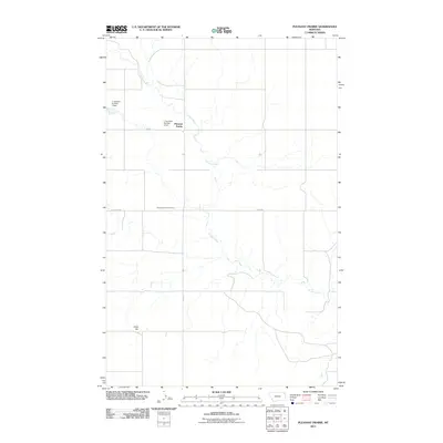
2011 Map of Pleasant Prairie
USGS Topo · Published 2011About this map
Pleasant Prairie anchors this corner of Roosevelt County, Montana, where the landscape is defined by the winding course of Smoke Creek. The map documents a predominantly rural expanse where water management is critical to local land use, evidenced by the presence of private water control structures like J Jacobsen Number 1 Dam and J Jacobsen Number 2 Dam. These features, along with landmarks such as Chris Hill, reflect the sparse but deliberate settlement of the high plains. For those researching local family history or land ownership, the Pleasant Prairie Cemetery serves as a significant genealogical landmark. The transportation network is centered around Fas 251 and the uniquely named 3 Corners Rd, illustrating the intersection of county roads that facilitate movement across these wide-open agricultural and ranching tracts.
Find a feature on this map
9 named features on this map. Tap any name to fly to it.
Don’t see what you’re looking for? This feature index may not catch every label — zoom into the map to look around manually.
Map Details
Editions of this 2011 Pleasant Prairie Map
This is the sole edition of this map. No revisions or reprints were ever made.
Other maps of this area

1909 · Smoke Creek
USGS Topo · 1:62,500

1912 · Hay Creek
USGS Topo · 1:62,500

1912 · Smoke Creek
USGS Topo · 1:62,500

1954 · Wolf Point
USGS Topo · 1:250,000

1958 · Wolf Point
USGS Topo · 1:250,000

1973 · Pleasant Prairie
USGS Topo · 1:24,000

1973 · Pleasant Prairie NW
USGS Topo · 1:24,000

1973 · Pleasant Prairie SW
USGS Topo · 1:24,000

1973 · Pleasant Prairie NE
USGS Topo · 1:24,000

1982 · Culbertson
USGS Topo · 1:100,000
Featured Places
- Brockton District, MT
- Pleasant Prairie, Brockton District
- Roosevelt County, MT
- Daniels County, MT
- United States