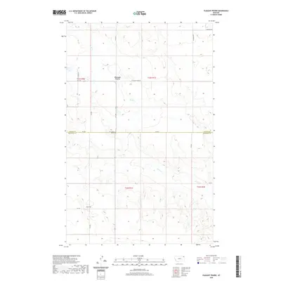
2020 Map of Pleasant Prairie
USGS Topo · Published 2020About this map
Pleasant Prairie anchors this high-plains landscape in Roosevelt County, where the grid of sections meets the shifting drainage of Smoke Cr. The map reveals a remote ranching and farming environment defined by long-distance section-line roads such as Navajo Rd and Jacobson Rd, and the historical path of the R-Y Trl. Genealogical interest centers on the Pleasant Prairie Cem, located near the intersection of the R-Y Trl and RD 2030. This specific topography includes Chris Hill in the southwestern quadrant, providing a rare vertical landmark in a region characterized by subtle breaks and coulees. The boundary between Roosevelt and Daniels counties is clearly marked, illustrating how political borders were etched into this prairie landscape alongside private land improvements and intermittent watercourses.
Find a feature on this map
21 named features on this map. Tap any name to fly to it.
Don’t see what you’re looking for? This feature index may not catch every label — zoom into the map to look around manually.
Map Details
Editions of this 2020 Pleasant Prairie Map
This is the sole edition of this map. No revisions or reprints were ever made.
Other maps of this area

1909 · Smoke Creek
USGS Topo · 1:62,500

1912 · Hay Creek
USGS Topo · 1:62,500

1912 · Smoke Creek
USGS Topo · 1:62,500

1954 · Wolf Point
USGS Topo · 1:250,000

1958 · Wolf Point
USGS Topo · 1:250,000

1973 · Pleasant Prairie
USGS Topo · 1:24,000

1973 · Pleasant Prairie NW
USGS Topo · 1:24,000

1973 · Pleasant Prairie SW
USGS Topo · 1:24,000

1973 · Pleasant Prairie NE
USGS Topo · 1:24,000

1982 · Culbertson
USGS Topo · 1:100,000
Featured Places
- Brockton District, MT
- Pleasant Prairie, Brockton District
- Roosevelt County, MT
- Daniels County, MT
- United States