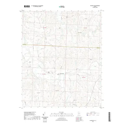
2020 Map of Pleasant Site
USGS Topo · Published 2020About this map
The Freedom Hills and the winding course of Cedar Creek dominate this 2020 landscape in Franklin County, Alabama. The area is characterized by a high concentration of small family and community burial grounds, which offer significant value for genealogical research in this part of the state. These include the Burns Family Cemetery, Sally Burns Cemetery, James Cemetery, and Bolton Cemetery. The map documents the rural settlement patterns around Pleasant Site and the community of Pogo near the Colbert County line.
Find a feature on this map
79 named features on this map. Tap any name to fly to it.
Don’t see what you’re looking for? This feature index may not catch every label — zoom into the map to look around manually.
Map Details
Editions of this 2020 Pleasant Site Map
This is the sole edition of this map. No revisions or reprints were ever made.
Other maps of this area

1925 · Barton
USGS Topo · 1:62,500

1926 · Barton
USGS Topo · 1:48,000

1929 · Barton
USGS Topo · 1:62,500

1935 · Pleasant Site
USGS Topo · 1:24,000

1936 · Belmont
USGS Topo · 1:24,000

1936 · Pleasant Grove
USGS Topo · 1:24,000

1936 · Red Bay
USGS Topo · 1:24,000
1936 · Barton
USGS Topo · 1:24,000

1936 · Halltown
USGS Topo · 1:24,000

1936 · Bishop
USGS Topo · 1:24,000