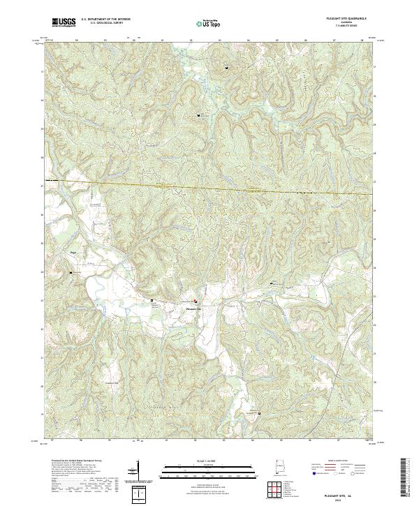
2024 Map of Pleasant Site
USGS Topo · Published 2024About this map
Pleasant Site serves as the focal point for this rural landscape in the Freedom Hills along the border of Colbert and Franklin Counties. The terrain is characterized by a dense network of drainages and named ridges, with Cedar Creek and its many tributaries, including Cody Branch and Shoat Mill Branch, cutting through the hills. This contemporary map documents a long history of local settlement through its numerous family and community burial grounds, such as Sally Burns Cem, the Perry-Bolton Cem, and Lower Pleasant Site Cem. The presence of labels like Starky Mill Branch and Ramsey Mill Branch points toward an early economy once tied to small-scale milling. Significant landmarks like Todd Ridge and Malone Hollow define the physical geography, while small communities like Pogo are connected by a network of county roads and local routes such as Troy Thorn Rd.
Find a feature on this map
77 named features on this map. Tap any name to fly to it.
Don’t see what you’re looking for? This feature index may not catch every label — zoom into the map to look around manually.
Map Details
Editions of this 2024 Pleasant Site Map
This is the sole edition of this map. No revisions or reprints were ever made.
Other maps of this area

1925 · Barton
USGS Topo · 1:62,500

1926 · Barton
USGS Topo · 1:48,000

1929 · Barton
USGS Topo · 1:62,500

1935 · Pleasant Site
USGS Topo · 1:24,000

1936 · Belmont
USGS Topo · 1:24,000

1936 · Pleasant Grove
USGS Topo · 1:24,000

1936 · Red Bay
USGS Topo · 1:24,000
1936 · Barton
USGS Topo · 1:24,000

1936 · Halltown
USGS Topo · 1:24,000

1936 · Bishop
USGS Topo · 1:24,000