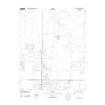
2012 Map of Pleasant Valley
USGS Topo · Published 2012About this map
Pleasant Valley and the northern outskirts of the Amarillo area are meticulously detailed in this early 21st-century topographic study. The landscape is defined by the drainage basins of E Amarillo Cr and Indian Cr, which carve through the plains toward 6 Section Lake. The map reveals a transition from dense residential street grids south of Dumas Dr to the more open ranching and industrial lands to the north. Smaller named locales such as Gluck and Juilliard represent the varied development patterns of Potter County, while Bivins Ranch highlights the persistent presence of large-scale landholdings. Notable infrastructure including Reclamation Rd and Ranch Road 2176 provides the primary framework for transportation through this part of the Texas Panhandle, bridging the gap between urban expansion and rural watersheds like Rosita Cr.
Find a feature on this map
123 named features on this map. Tap any name to fly to it.
Don’t see what you’re looking for? This feature index may not catch every label — zoom into the map to look around manually.
Map Details
Editions of this 2012 Pleasant Valley Map
This is the sole edition of this map. No revisions or reprints were ever made.
Other maps of this area

1934 · Cliffside
USGS Topo · 1:62,500

1936 · Cliffside
USGS Topo · 1:62,500

1953 · Chunky
USGS Topo · 1:24,000

1953 · Puente
USGS Topo · 1:24,000

1953 · Pleasant Valley
USGS Topo · 1:24,000

1953 · Mayer
USGS Topo · 1:24,000

1953 · Cliffside
USGS Topo · 1:24,000

1953 · Berry Sand Draw
USGS Topo · 1:24,000

1954 · Amarillo
USGS Topo · 1:250,000

1956 · Amarillo East
USGS Topo · 1:24,000