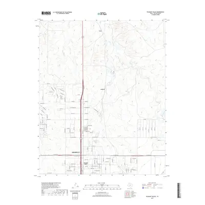
2019 Map of Pleasant Valley
USGS Topo · Published 2019About this map
The northern reaches of Amarillo transition into the Panhandle plains in this 2019 survey, defined by the drainage systems of E Amarillo Cr and Indian Cr. The landscape is a mix of dense residential development in the south and more open, rugged drainage basins to the north near Gluck and Juilliard. The residential street grid in the Pleasant Valley area gives way to a network of themed roads such as Chief Joseph Trl, Nez Perce Trl, and Arkansas Trl, reflecting the planned growth of Potter County suburban communities. The map highlights the intersection of modern transportation corridors like St-Francis Ave with the natural topography created by Rosita Cr, showing how the city has expanded across the high plains environment.
Find a feature on this map
102 named features on this map. Tap any name to fly to it.
Don’t see what you’re looking for? This feature index may not catch every label — zoom into the map to look around manually.
Map Details
Editions of this 2019 Pleasant Valley Map
This is the sole edition of this map. No revisions or reprints were ever made.
Other maps of this area

1934 · Cliffside
USGS Topo · 1:62,500

1936 · Cliffside
USGS Topo · 1:62,500

1953 · Chunky
USGS Topo · 1:24,000

1953 · Puente
USGS Topo · 1:24,000

1953 · Pleasant Valley
USGS Topo · 1:24,000

1953 · Mayer
USGS Topo · 1:24,000

1953 · Cliffside
USGS Topo · 1:24,000

1953 · Berry Sand Draw
USGS Topo · 1:24,000

1954 · Amarillo
USGS Topo · 1:250,000

1956 · Amarillo East
USGS Topo · 1:24,000