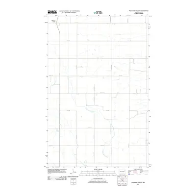
2011 Map of Pleasant Valley
USGS Topo · Published 2011About this map
Pleasant Valley anchors the northwestern corner of this 2011 survey, a region defined by the expansive agricultural grid of Walsh County. The landscape is primarily shaped by a network of sectional roads, including 66th St NE and 58th St NE, which facilitate the movement of local goods and travel across the plains. Meandering through the central and southern portions of the map, the North Branch Forest River provides a natural break in the otherwise structured township lines. This drainage system represents the primary topographical variation in the area, cutting a subtle path through the farmland. Local transit is supported by arterial routes such as County Rd 15 and County Rd 12B, which connect the scattered rural homesteads and agricultural operations that characterize the settlement pattern of this North Dakota quadrangle.
Find a feature on this map
18 named features on this map. Tap any name to fly to it.
Don’t see what you’re looking for? This feature index may not catch every label — zoom into the map to look around manually.
Map Details
Editions of this 2011 Pleasant Valley Map
This is the sole edition of this map. No revisions or reprints were ever made.
Other maps of this area

1952 · Thief River Falls
USGS Topo · 1:250,000

1956 · Thief River Falls
USGS Topo · 1:250,000

1957 · Thief River Falls
USGS Topo · 1:250,000

1963 · Edinburg
USGS Topo · 1:24,000

1963 · Pleasant Valley
USGS Topo · 1:24,000

1963 · Pisek
USGS Topo · 1:24,000

1963 · Fordville
USGS Topo · 1:24,000

1963 · Park River
USGS Topo · 1:24,000
1963 · Inkster
USGS Topo · 1:24,000

1967 · Thief River Falls
USGS Topo · 1:250,000