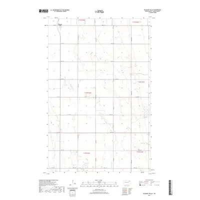
2017 Map of Pleasant Valley
USGS Topo · Published 2017About this map
The Pleasant Valley area in Walsh County is defined by its vast agricultural grid, punctuated by the winding course of the N Br Forest River. This 2017 survey reflects the persistent rural character of the North Dakota prairie, where section lines are strictly maintained by a network of gravel and paved roads such as 66th St NE and Co Rd 15. The drainage of the river creates the only significant breaks in the level terrain, offering a look at the natural hydrology that influenced early settlement patterns in this part of the Red River Valley region. While the landscape is largely dominated by cultivation, local connectors like Prairie Trl and Co Hwy 19 provide the modern framework for the township's transit and commerce.
Find a feature on this map
19 named features on this map. Tap any name to fly to it.
Don’t see what you’re looking for? This feature index may not catch every label — zoom into the map to look around manually.
Map Details
Editions of this 2017 Pleasant Valley Map
This is the sole edition of this map. No revisions or reprints were ever made.
Other maps of this area

1952 · Thief River Falls
USGS Topo · 1:250,000

1956 · Thief River Falls
USGS Topo · 1:250,000

1957 · Thief River Falls
USGS Topo · 1:250,000

1963 · Edinburg
USGS Topo · 1:24,000

1963 · Pleasant Valley
USGS Topo · 1:24,000

1963 · Pisek
USGS Topo · 1:24,000

1963 · Fordville
USGS Topo · 1:24,000

1963 · Park River
USGS Topo · 1:24,000
1963 · Inkster
USGS Topo · 1:24,000

1967 · Thief River Falls
USGS Topo · 1:250,000