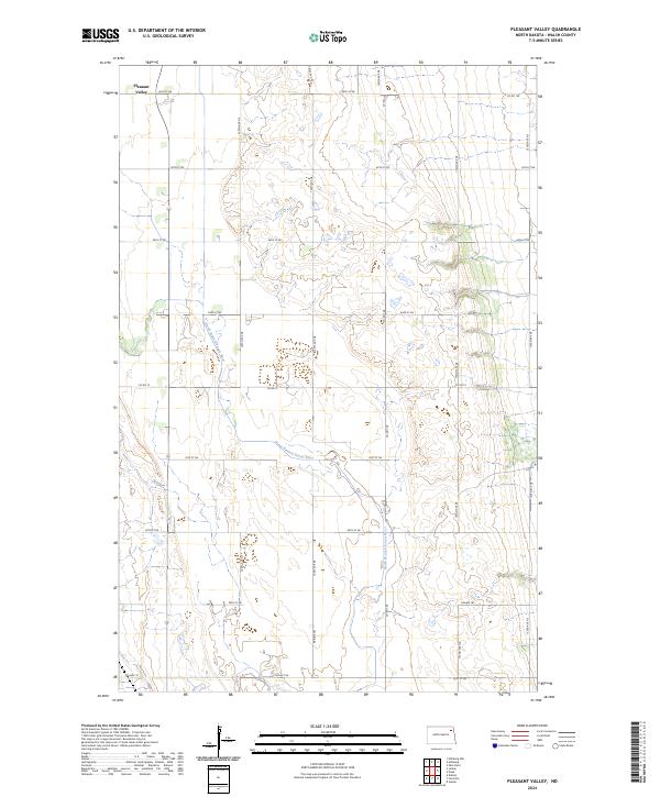
2024 Map of Pleasant Valley
USGS Topo · Published 2024About this map
North Branch Forest River meanders across this rural Walsh County landscape, defining the topography of an area dominated by agricultural sections and a precise grid of section roads. The northern portion of the map is anchored by Pleasant Valley, where the drainage patterns of the river system create the only significant breaks in the geometric landscape. This contemporary survey illustrates the persistent importance of the township and range system, with boundaries like t156n r56w and t157n r55w organizing the territory. Transportation is facilitated by a network of county routes, including Co Hwy 19 and Co Rd 15, alongside localized paths such as Prairie Trl. This map serves as a clear record of modern prairie land use, showing the distribution of farmsteads and the relationship between the local road network and the natural watercourse of the Forest River.
Find a feature on this map
25 named features on this map. Tap any name to fly to it.
Don’t see what you’re looking for? This feature index may not catch every label — zoom into the map to look around manually.
Map Details
Editions of this 2024 Pleasant Valley Map
This is the sole edition of this map. No revisions or reprints were ever made.
Other maps of this area

1952 · Thief River Falls
USGS Topo · 1:250,000

1956 · Thief River Falls
USGS Topo · 1:250,000

1957 · Thief River Falls
USGS Topo · 1:250,000

1963 · Edinburg
USGS Topo · 1:24,000

1963 · Pleasant Valley
USGS Topo · 1:24,000

1963 · Pisek
USGS Topo · 1:24,000

1963 · Fordville
USGS Topo · 1:24,000

1963 · Park River
USGS Topo · 1:24,000
1963 · Inkster
USGS Topo · 1:24,000

1967 · Thief River Falls
USGS Topo · 1:250,000