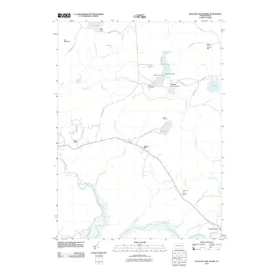
2010 Map of Pleasant View Summit
USGS Topo · Published 2010About this map
Stoddartsville sits at the southeastern edge of this landscape, marking a historical crossing point where the Lehigh River tumbles over the Great Falls of the Lehigh. The area is defined by its complex hydrology, with numerous impoundments including Meadow Lake, Indian Lake, and Lake Aleeda feeding a network of runs and creeks. The terrain rises to prominent heights at Bald Mountain and Dry Land Hill, the latter of which is crowned by the Dry Land Hill Tower. While much of the region is characterized by woods and waterways, recreational developments like the Wilkes-Barre Golf Course and small residential clusters such as Pleasant View Summit and Shades Glen illustrate the modern use of this highland terrain for leisure and retreat near the turn of the 21st century.
Find a feature on this map
53 named features on this map. Tap any name to fly to it.
Don’t see what you’re looking for? This feature index may not catch every label — zoom into the map to look around manually.
Map Details
Editions of this 2010 Pleasant View Summit Map
This is the sole edition of this map. No revisions or reprints were ever made.
Other maps of this area

1889 · Scranton
USGS Topo · 1:62,500

1891 · Wilkesbarre
USGS Topo · 1:62,500

1891 · Scranton
USGS Topo · 1:62,500

1893 · Pittston
USGS Topo · 1:62,500

1893 · Scranton
USGS Topo · 1:62,500

1894 · Wilkesbarre
USGS Topo · 1:62,500

1922 · Stoddartsville
USGS Topo · 1:62,500

1924 · Stoddartsville
USGS Topo · 1:62,500

1943 · Scranton
USGS Topo · 1:125,000

1943 · Stoddartsville
USGS Topo · 1:62,500
Featured Places
- Thornhurst Township, PA
- Kidder Township, PA
- Buck Township, PA
- Bear Creek Township, PA
- Tobyhanna Township, PA