1906 Map of Pleasanton
USGS Topo · Published 1928About this map
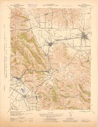
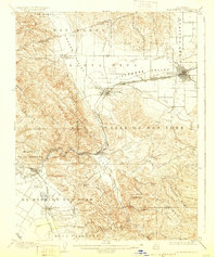
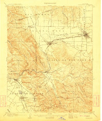
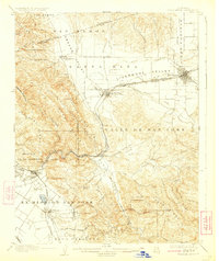
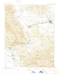
The Livermore Valley and San Ramon Valley converge in this 1904 survey, documenting a landscape of early California ranching and agriculture defined by its arroyo systems. The confluence of the Southern Pacific and Western Pacific railroads at Pleasanton and Livermore reveals the importance of rail transit in connecting these interior valleys to the coast. Prominent historical landmarks like Mission San Jose and Irvington anchor the southwestern corner of the map near the Ex Mission San Jose land grant. The mapping of now-obscure points like Dougherty P.O. and Sunolglen P.O. provides a precise view of the rural postal and transport network before significant suburban expansion. Distinctive terrain features such as Pleasanton Ridge and Maguire Peaks separate the developed valleys from the more remote canyons of the Valpe Ridge.
Find a feature on this map
64 named features on this map. Tap any name to fly to it.
Don’t see what you’re looking for? This feature index may not catch every label — zoom into the map to look around manually.
Map Details
Editions of this 1906 Pleasanton Map
5 editions found

Historical Maps of Fremont Through Time
3 maps found