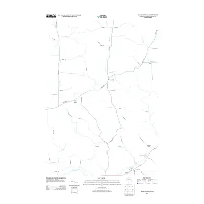
2013 Map of Pleasantville
USGS Topo · Published 2013About this map
Pleasantville serves as the central hub of this Trempealeau County landscape, situated where N Br Elk Cr meets the main branch of Elk Cr. The topography is defined by its coulees—distinctive valley systems like Dissmore Coulee and Sjuggerud Coulee that drain toward the Trempealeau River at the southern edge of the sheet. Smaller hamlets such as Hale and Coral City anchor the rural road network, which follows the natural winding paths of the stream beds and ridgelines. The transition from the more developed corridor near Coral City and Pigeon Cr to the more isolated stretches of Sleepy Valley illustrates the varied agricultural and residential patterns of Western Wisconsin. Local history is etched into the landscape through family-named thoroughfares and geographic features like Thompson Coulee, reflecting a long-standing relationship between the community and the driftless-style terrain of the region.
Find a feature on this map
56 named features on this map. Tap any name to fly to it.
Don’t see what you’re looking for? This feature index may not catch every label — zoom into the map to look around manually.
Map Details
Editions of this 2013 Pleasantville Map
This is the sole edition of this map. No revisions or reprints were ever made.
Other maps of this area

1926 · Whitehall
USGS Topo · 1:62,500

1927 · Blair
USGS Topo · 1:62,500

1927 · Strum
USGS Topo · 1:62,500

1929 · Whitehall
USGS Topo · 1:62,500

1930 · Strum
USGS Topo · 1:62,500

1935 · Osseo
USGS Topo · 1:48,000

1940 · Osseo
USGS Topo · 1:62,500

1953 · Eau Claire
USGS Topo · 1:250,000

1958 · Eau Claire
USGS Topo · 1:250,000

1964 · Eau Claire
USGS Topo · 1:250,000