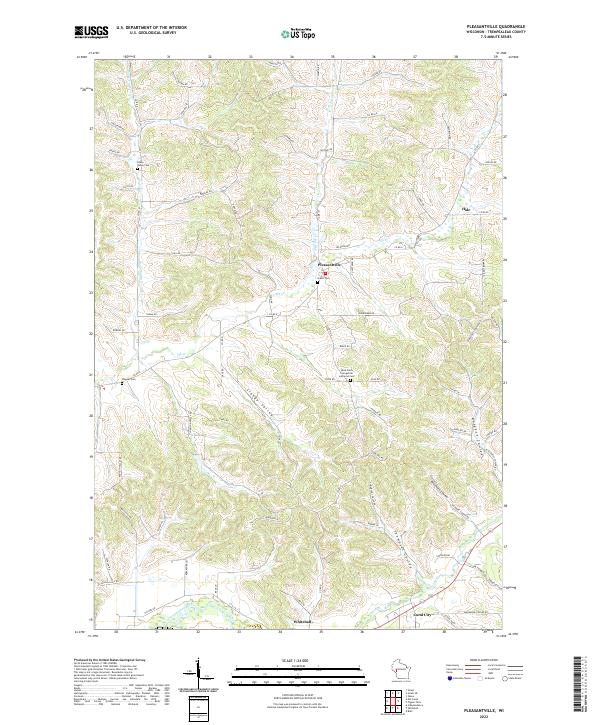
2022 Map of Pleasantville
USGS Topo · Published 2022About this map
Pleasantville and the surrounding Trempealeau County countryside are defined by a rhythmic landscape of ridges and deep valleys known locally as coulees. This 2022 survey captures the rural character of western Wisconsin, where settlements like Hale and Coral City sit among winding waterways like Pigeon Creek and the Trempealeau River. The map is particularly useful for genealogical research, documenting several distinct burial sites including Bruce Valley Cem and the Saint Paul's Evangelical Lutheran Cem near the town center. The terrain is marked by prominent natural features such as Sleepy Valley and Thompson Coulee, illustrating how the local geography influenced the winding path of roads like Co Rd E and Co Rd D. This detailed record shows the modern layout of family-named roads and remote farmsteads that have persisted in the region for generations.
Find a feature on this map
77 named features on this map. Tap any name to fly to it.
Don’t see what you’re looking for? This feature index may not catch every label — zoom into the map to look around manually.
Map Details
Editions of this 2022 Pleasantville Map
This is the sole edition of this map. No revisions or reprints were ever made.
Other maps of this area

1926 · Whitehall
USGS Topo · 1:62,500

1927 · Blair
USGS Topo · 1:62,500

1927 · Strum
USGS Topo · 1:62,500

1929 · Whitehall
USGS Topo · 1:62,500

1930 · Strum
USGS Topo · 1:62,500

1935 · Osseo
USGS Topo · 1:48,000

1940 · Osseo
USGS Topo · 1:62,500

1953 · Eau Claire
USGS Topo · 1:250,000

1958 · Eau Claire
USGS Topo · 1:250,000

1964 · Eau Claire
USGS Topo · 1:250,000