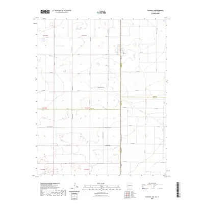
2023 Map of Pleasure Lake
USGS Topo · Published 2023About this map
The high plains of the Llano Estacado define this landscape along the border of New Mexico and Texas. Settled primarily by agricultural interests, the area is partitioned by an extensive network of county roads such as Curry Road C and Co RD 1008 that trace the township and range lines. The topography is marked by ephemeral depressions and drainage features, most notably Pleasure Lake in the north and the winding path of Blackwater Draw. These natural catchments are vital markers in a region where water management dictates the patterns of rural life. Near the state line, Mount Olivet Cem serves as a significant genealogical landmark for local families. The map illustrates the meeting point of Curry and Roosevelt Counties in New Mexico with Parmer and Bailey Counties in Texas, showing how modern transportation routes like FM 3125 bridge these jurisdictional boundaries.
Find a feature on this map
41 named features on this map. Tap any name to fly to it.
Don’t see what you’re looking for? This feature index may not catch every label — zoom into the map to look around manually.
Map Details
Editions of this 2023 Pleasure Lake Map
This is the sole edition of this map. No revisions or reprints were ever made.
Other maps of this area

1954 · Clovis
USGS Topo · 1:250,000

1957 · Clovis
USGS Topo · 1:62,500

1957 · Arch
USGS Topo · 1:62,500

1958 · Clovis
USGS Topo · 1:250,000

1962 · Birdwell Ranch
USGS Topo · 1:24,000

1963 · Lariat
USGS Topo · 1:24,000

1963 · Oklahoma Lane
USGS Topo · 1:24,000

1985 · Midway
USGS Topo · 1:24,000

1985 · Pleasure Lake
USGS Topo · 1:24,000

1985 · Muleshoe
USGS Topo · 1:100,000