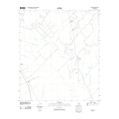
2010 Map of Pledger
USGS Topo · Published 2010About this map
Caney Creek winds through this coastal prairie landscape, anchoring a network of small settlements and agricultural transit routes. The community of Pledger sits central to the map, while the southwestern corner is marked by Magnet, a townsite defined by its grid near the intersection of Barbee Rd and Mauldin Rd. The importance of drainage and local hydrology is evident in the named waterways like Water Hole Creek, Quinine Slough, and the nearby Big Lake. For genealogists and local historians, Union Cemetery provides a specific point of interest south of the Caney Creek bends. The settlement patterns of Newgulf Junction and Don-Tol reflect the rural infrastructure of Wharton County, linked by farm roads and secondary routes that crisscross the low-lying terrain.
Find a feature on this map
30 named features on this map. Tap any name to fly to it.
Don’t see what you’re looking for? This feature index may not catch every label — zoom into the map to look around manually.
Map Details
Editions of this 2010 Pledger Map
This is the sole edition of this map. No revisions or reprints were ever made.
Other maps of this area

1950 · Houston
USGS Topo · 1:250,000

1952 · Danciger
USGS Topo · 1:24,000

1952 · Ashwood
USGS Topo · 1:24,000

1952 · Lane City SE
USGS Topo · 1:24,000

1952 · Pledger
USGS Topo · 1:24,000

1952 · Lane City
USGS Topo · 1:24,000

1952 · Van Vleck
USGS Topo · 1:24,000

1953 · Guy
USGS Topo · 1:24,000

1953 · Wharton
USGS Topo · 1:24,000

1953 · Boling
USGS Topo · 1:24,000