
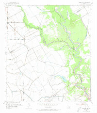
1952 Map of Lane City SE
USGS Topo · Published 1953About this map
The Colorado River meanders across the border of Wharton and Matagorda Counties, shaping a landscape defined by oxbow lakes and early industrial expansion. In the early 1950s, the region was characterized by a transition from traditional ranching and farming to active petroleum extraction, evidenced by the North Markham Oil Field and Bay City Oil Field. These fields sit alongside an intricate network of water features, including Jennings Lake, Silver Lake, and Neal Lake, which illustrate the river's historical shifts.
Find a feature on this map
14 named features on this map. Tap any name to fly to it.
Don’t see what you’re looking for? This feature index may not catch every label — zoom into the map to look around manually.
Map Details
Editions of this 1952 Lane City SE Map
3 editions found
Other maps of this area

1950 · Houston
USGS Topo · 1:250,000

1951 · Bay City
USGS Topo · 1:250,000

1951 · Danevang
USGS Topo · 1:24,000

1952 · Pledger
USGS Topo · 1:24,000

1952 · Bay City
USGS Topo · 1:24,000

1952 · Markham
USGS Topo · 1:24,000

1952 · Lane City
USGS Topo · 1:24,000

1952 · Van Vleck
USGS Topo · 1:24,000

1952 · Midfield
USGS Topo · 1:24,000

1952 · Pierce
USGS Topo · 1:24,000