
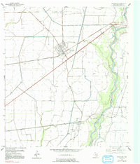
1952 Map of Markham
USGS Topo · Published 1953About this map
Markham sits at the junction of rail and road, serving as a hub for the surrounding Matagorda County coastal plains. The Southern Pacific and Missouri Pacific lines dominate the transport corridors, reflecting the area's mid-century reliance on heavy rail for moving oil and agricultural goods. To the north, the North Markham Oil Field and scattered oil wells across the landscape indicate the region's productive petroleum industry during the early 1950s.
Find a feature on this map
16 named features on this map. Tap any name to fly to it.
Don’t see what you’re looking for? This feature index may not catch every label — zoom into the map to look around manually.
Map Details
Editions of this 1952 Markham Map
2 editions found
Other maps of this area

1950 · Houston
USGS Topo · 1:250,000

1951 · Bay City
USGS Topo · 1:250,000

1951 · Danevang
USGS Topo · 1:24,000

1952 · Lane City SE
USGS Topo · 1:24,000

1952 · Blessing SE
USGS Topo · 1:24,000

1952 · Blessing
USGS Topo · 1:24,000

1952 · Bay City
USGS Topo · 1:24,000

1952 · Van Vleck
USGS Topo · 1:24,000

1952 · Midfield
USGS Topo · 1:24,000

1952 · Wadsworth
USGS Topo · 1:24,000