
1952 Map of Wadsworth
USGS Topo · Published 1953About this map
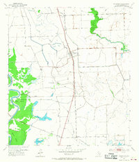
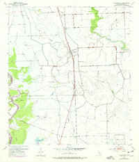
Colorado River bottomlands and coastal prairie define this early 1950s survey of southeastern Texas. The landscape is a network of drainage and water management, marked by numerous levee systems protecting agricultural lands and the East Reservoir. The small settlement of Wadsworth serves as a local hub along the Gulf Colorado and Santa Fe railroad, while smaller points like Rymers and Gulf Hill mark the rail line's path toward the coast.
Find a feature on this map
20 named features on this map. Tap any name to fly to it.
Don’t see what you’re looking for? This feature index may not catch every label — zoom into the map to look around manually.
Map Details
Editions of this 1952 Wadsworth Map
3 editions found
Other maps of this area

1951 · Bay City
USGS Topo · 1:250,000

1952 · Lake Austin
USGS Topo · 1:24,000

1952 · Matagorda
USGS Topo · 1:24,000

1952 · Blessing SE
USGS Topo · 1:24,000

1952 · Dressing Point
USGS Topo · 1:24,000

1952 · Bay City
USGS Topo · 1:24,000

1952 · Markham
USGS Topo · 1:24,000

1952 · Bay City NE
USGS Topo · 1:24,000

1952 · Palacios NE
USGS Topo · 1:24,000

1953 · Beeville
USGS Topo · 1:250,000