
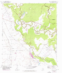
1952 Map of Bay City NE
USGS Topo · Published 1953About this map
Meandering watercourses and small rural enclaves define this coastal prairie landscape along the Brazoria Co Matagorda Co line. The terrain is dominated by the intricate loops of Caney Creek, which is flanked by numerous family and community landmarks such as Matthews Cem and Andrews Cem. The settlement pattern follows these natural levees, with the small community of Rugeley and the Old Hardeman Railroad Grade suggesting the earlier transit and agricultural corridors of the region. Evidence of local spiritual and educational life is found in clusters like Vine Grove Ch and the nearby Vine Grove Sch. A network of water features including Wildcat Slough and Live Oak Bayou emphasizes the low-lying, hydrologically active nature of the Gulf Coast plains, where flowing wells and levees manage the relationship between the land and the water.
Find a feature on this map
27 named features on this map. Tap any name to fly to it.
Don’t see what you’re looking for? This feature index may not catch every label — zoom into the map to look around manually.
Map Details
Editions of this 1952 Bay City NE Map
2 editions found
Other maps of this area

1950 · Houston
USGS Topo · 1:250,000

1951 · Bay City
USGS Topo · 1:250,000

1952 · Sweeny
USGS Topo · 1:24,000

1952 · Ashwood
USGS Topo · 1:24,000

1952 · Lake Austin
USGS Topo · 1:24,000

1952 · Bay City
USGS Topo · 1:24,000

1952 · Van Vleck
USGS Topo · 1:24,000

1952 · Cedar Lane
USGS Topo · 1:24,000

1952 · Sargent
USGS Topo · 1:24,000

1952 · Wadsworth
USGS Topo · 1:24,000