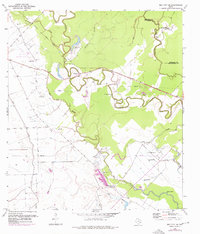
1952 Map of Bay City NE
USGS Topo · Published 1976About this map
Meandering bayous and rural family landmarks define this landscape on the Brazoria and Matagorda county line during the mid-century. The intricate winding path of Caney Creek dominates the center of the sheet, surrounded by a high density of rural religious and burial sites including the Andrews Cem and Mt Pilgrim Ch. These sites, often bearing family names like the Hudgins Cem and Matthews Cem, suggest a deeply rooted agricultural community tied to the fertile lowlands.
Find a feature on this map
28 named features on this map. Tap any name to fly to it.
Don’t see what you’re looking for? This feature index may not catch every label — zoom into the map to look around manually.
Map Details
Editions of this 1952 Bay City NE Map
2 editions found
Other maps of this area

1950 · Houston
USGS Topo · 1:250,000

1951 · Bay City
USGS Topo · 1:250,000

1952 · Sweeny
USGS Topo · 1:24,000

1952 · Ashwood
USGS Topo · 1:24,000

1952 · Lake Austin
USGS Topo · 1:24,000

1952 · Bay City
USGS Topo · 1:24,000

1952 · Bay City NE
USGS Topo · 1:24,000

1952 · Van Vleck
USGS Topo · 1:24,000

1952 · Cedar Lane
USGS Topo · 1:24,000

1952 · Sargent
USGS Topo · 1:24,000