
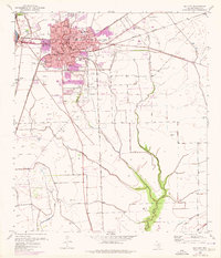
1952 Map of Bay City
USGS Topo · Published 1953About this map
Bay City stands as a central hub of coastal Texas industry and education in the early 1950s, anchored by a dense network of schools including the Jefferson Davis Sch, Hilliard Sch, and Holy Cross Sch. The town's economic character is defined by its proximity to the natural resources of the gulf coast, evidenced by a prominent Oil Refinery and numerous oil wells scattered across the prairie. The landscape is a complex web of drainage and transit, where Cottonwood Creek and Bucks Bayou wind through fields protected by a sophisticated levee system. Three major rail lines converge here—the Southern Pacific, Missouri Pacific, and Gulf Colorado and Santa Fe—facilitating the movement of goods from local agriculture and the petroleum sector. Notable community landmarks such as the Livestock Show Grounds and the Radio Station (KIOX) indicate a thriving mid-century regional center.
Find a feature on this map
32 named features on this map. Tap any name to fly to it.
Don’t see what you’re looking for? This feature index may not catch every label — zoom into the map to look around manually.
Map Details
Editions of this 1952 Bay City Map
2 editions found
Other maps of this area

1950 · Houston
USGS Topo · 1:250,000

1951 · Bay City
USGS Topo · 1:250,000

1952 · Ashwood
USGS Topo · 1:24,000

1952 · Lake Austin
USGS Topo · 1:24,000

1952 · Lane City SE
USGS Topo · 1:24,000

1952 · Blessing SE
USGS Topo · 1:24,000

1952 · Markham
USGS Topo · 1:24,000

1952 · Bay City NE
USGS Topo · 1:24,000

1952 · Van Vleck
USGS Topo · 1:24,000

1952 · Wadsworth
USGS Topo · 1:24,000