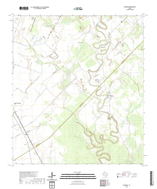
2022 Map of Pledger
USGS Topo · Published 2022About this map
Caney Creek winds through the lowlands of the Texas Gulf Coast, defining the boundary between Wharton and Matagorda counties. This modern survey illustrates the persistent rural character of the region, where the settlement of Pledger serves as a local hub near Caney Creek. To the west, the crossroads of Magnet and the rail-oriented Cane Junction represent the historical agricultural and transport network of the coastal prairie. The landscape is marked by a complex system of sloughs and creeks, including Gardner Slough, Quinine Slough, and Water Hole Creek. Genealogists will find several burial sites preserved across the landscape, notably Old Bethlehem Cemetery, Union Cemetery, and New Gulf Cemetery. In the northern reach, the Giles VA Ranch Airport and the community of Don-Tol highlight the continued integration of private landholdings and small-scale infrastructure in this alluvial plain.
Find a feature on this map
48 named features on this map. Tap any name to fly to it.
Don’t see what you’re looking for? This feature index may not catch every label — zoom into the map to look around manually.
Map Details
Editions of this 2022 Pledger Map
This is the sole edition of this map. No revisions or reprints were ever made.
Other maps of this area

1950 · Houston
USGS Topo · 1:250,000

1952 · Danciger
USGS Topo · 1:24,000

1952 · Ashwood
USGS Topo · 1:24,000

1952 · Lane City SE
USGS Topo · 1:24,000

1952 · Pledger
USGS Topo · 1:24,000

1952 · Lane City
USGS Topo · 1:24,000

1952 · Van Vleck
USGS Topo · 1:24,000

1953 · Guy
USGS Topo · 1:24,000

1953 · Wharton
USGS Topo · 1:24,000

1953 · Boling
USGS Topo · 1:24,000