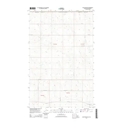
2014 Map of Plentywood NW
USGS Topo · Published 2014About this map
Harrys Cr and Plentywood Cr provide the primary drainage for this section of Sheridan County along the United States-Canada border. The landscape is defined by a dense grid of rural corridors and section lines, many of which carry names reflecting local geography and homesteading legacy. Notable routes include Chalk Butte Rd and Hendrickson Hill Rd, which traverse the undulating northern plains. Along the southern edge, the influence of regional transportation is evident with Sooline Rd and Santa Fe Rd, referencing the historic rail networks that once moved agriculture across these prairies. The map details a high concentration of small, unnamed water bodies and wetlands interspersed among the section blocks of t37n r53e and t37n r54e, highlighting the complex hydrology of the High Plains before reaching the international boundary.
Find a feature on this map
20 named features on this map. Tap any name to fly to it.
Don’t see what you’re looking for? This feature index may not catch every label — zoom into the map to look around manually.
Map Details
Editions of this 2014 Plentywood NW Map
This is the sole edition of this map. No revisions or reprints were ever made.
Other maps of this area

1954 · Wolf Point
USGS Topo · 1:250,000

1958 · Wolf Point
USGS Topo · 1:250,000

1983 · Plentywood NW
USGS Topo · 1:24,000

1983 · Outlook
USGS Topo · 1:24,000

1983 · Archer
USGS Topo · 1:24,000

1983 · Plentywood
USGS Topo · 1:24,000

1983 · Raymond
USGS Topo · 1:24,000
1983 · Plentywood SW
USGS Topo · 1:24,000
2011 · Plentywood SW
USGS Topo · 1:24,000
2011 · Plentywood
USGS Topo · 1:24,000