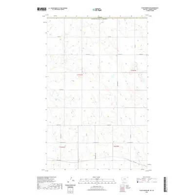
2020 Map of Plentywood NW
USGS Topo · Published 2020About this map
The United States-Canada border marks the northern edge of this high plains landscape, where the rural infrastructure of Sheridan County meets the international boundary. The southern portion of the map is defined by the Soo Line Rd corridor, a significant historical transit artery running roughly parallel to Outlook Bench Rd. Water features are scarce in this arid region, primarily represented by the winding paths of Plentywood Cr and Harrys Cr. The land is organized into a rigid section grid, serviced by a network of descriptive local routes such as Hendrickson Hill Rd and Chalk Butte Rd. This survey highlights the intersection of late 20th-century water management data with early 20th-century land division, capturing a sparsely populated corner of Montana dominated by large-scale agricultural blocks and the enduring path of the Soo Line.
Find a feature on this map
17 named features on this map. Tap any name to fly to it.
Don’t see what you’re looking for? This feature index may not catch every label — zoom into the map to look around manually.
Map Details
Editions of this 2020 Plentywood NW Map
This is the sole edition of this map. No revisions or reprints were ever made.
Other maps of this area

1954 · Wolf Point
USGS Topo · 1:250,000

1958 · Wolf Point
USGS Topo · 1:250,000

1983 · Plentywood NW
USGS Topo · 1:24,000

1983 · Outlook
USGS Topo · 1:24,000

1983 · Archer
USGS Topo · 1:24,000

1983 · Plentywood
USGS Topo · 1:24,000

1983 · Raymond
USGS Topo · 1:24,000
1983 · Plentywood SW
USGS Topo · 1:24,000
2011 · Plentywood SW
USGS Topo · 1:24,000
2011 · Plentywood
USGS Topo · 1:24,000